| Origin & Development | |
|
Legends & Fairy tales • Earth's Crust Thickness • Underwater Relief • Landscapes • History & Formation • Seismic Activity • | |
| History of Lake Baikal | |
|
History of Explorations • Inhabitants & Settlers • First maps of Baikal • Archaeological Sites • | |
| Lake Baikal Climate | |
|
Introduction • Fogs • Winds & Waves • Ice Conditions • | |
| Fauna & Vegetation | |
|
Mammals • Baikal seal - Nerpa • Ichthyofauna • Invertebrates • Vegetation • | |
| Water of Lake Baikal | |
|
Colour • Transparency • Temperature • Pressure • Depth • Currents • Budget • Chemical Composition • Pollution • | |
| Recreational Areas | |
|
Circumbaikal Railway • Peschanaya Bays • Olkhon Island • Chivirkuysky Gulf • Wooden Irkutsk • Trans-Siberian Railway • | |
| People of Lake Baikal | |
|
People of Siberia • Buryat nation in Baikal • Russians in Baikal • | |
|
| |
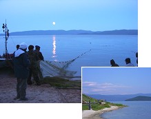
Chivirkuysky Gulf / Holy Nose Peninsula
From the north to the south for almost 54 km stretches the mountainous Svyatoi Nos peninsula. It is separated from the mainland by a narrow and low sandy belt. The same belt separates Barguzinsky and Chivyrkuysky Bays. Opposite the peninsula one can see four Ushkani Islands: Bolshoi (Big) and three small ones (Tonky, Krugly and Dolgy). Bolshoi Ushkany island is the habitat of the alpine hare and a multitude of ants, so that the whole island is covered with large, tall ant hills. One's attention is also attracted by small bottle-like bulges on the larch trunks. The Malye (small) Ushkani Islands are famous as a resting place for nerpa (the Baikal seal). Barguzinsky Bay is the biggest and the deepest on Baikal. Along its shoreline stretches a huge dune several metres wide. There are sandy hills, the hollows between which are overgrown with trailing and common cedar. Their typical flag-like crowns point to the prevailing "from the sea" direction of the wind. On sunny days the coarse red sand is warmed up so that it's impossible to go barefoot! A solid sandy bottom, warm water, the lowland isthmus close to abundant shallow waters from where cranes' cry can be heard, picturesque panoramas of the peninsula, Chivyrkuysky slopes and Barguzinsky bay make Barguzinsky dune a wonderful and unforgettable resting place. A tourist base "Maximikha" is situated in the southern and the most remarkable part of Barguzinsky Bay. The Barguzinsky highway runs through the neighbouring settlement of Maximikha. |