|
|
|
| Origin & Development |
•
•
•
•
•
• |
| History of Lake Baikal |
•
•
•
• |
| Lake Baikal Climate |
•
•
•
• |
| Fauna & Vegetation |
•
•
•
•
• |
| Water of Lake Baikal |
•
•
•
•
•
•
•
•
• |
| Recreational Areas |
•
•
•
•
•
• |
| People of Lake Baikal |
•
•
• |
|
|
|
|
|
|
|
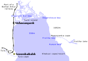
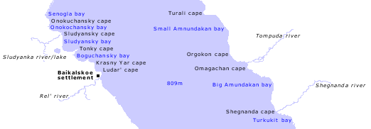
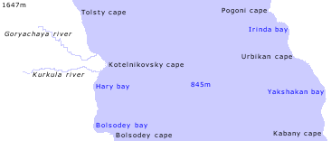
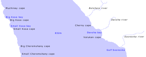
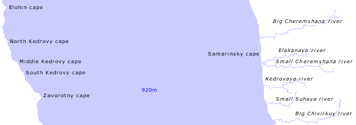
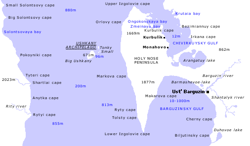
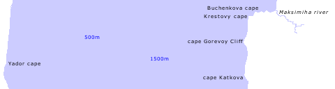
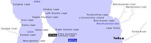
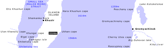
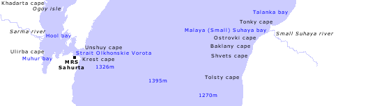
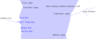
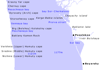
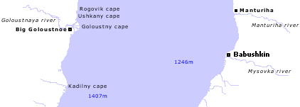
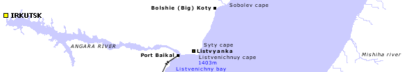
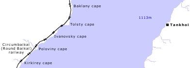
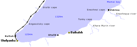
Lake Baikal Map
Scale (approximately) - 1:750000 / 1cm = 7.5 km
- the map covers in detail the surface of Baikal lake and 5 - 7 km of the inland.
- the map shows in detail all capes, bays and gulfs;
- the map shows only main rivers, villages, towns, depths and altitudes (below / above
the lake's surface level) > the lake surface area above the sea level /
altitude = 454 m;
- the map does not include roads and highways |
|
|
|
|
|
|
|
|
|
|
|
|
|
|
|
|
|
|
|
This map is for personal use only.
Copying or distributing
is forbidden without prior written permission.
|
|
|
|